Maps of the Sourland Mountains – great detail 
Sourland Mountain Comprehensive Management Plan,
published November 17 2010. The complete document is located HERE
To view the maps, click on the link, in Blue, directly below the title – the map will open in Adobe and may take a few moments to appear.
If the Adobe Toolbar does not appear, position the mouse over the center bottom of map to view functions available.
You may: View, Download, Print, Expand, Shrink, or Move about the map.
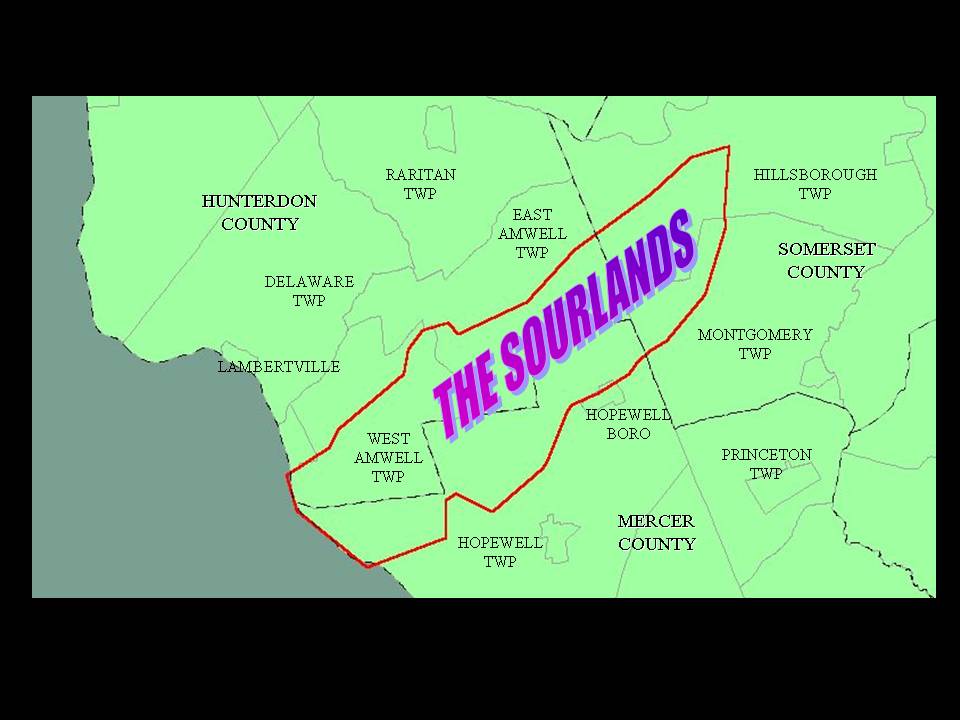
Regional Location (#1)
http://www.sourland.org/alliance/Map1.pdf
Sourland Mountain Region (#2)
http://www.sourland.org/alliance/Map2.pdf
Riparian Areas (#3)
http://www.sourland.org/alliance/Map3.pdf
Wetlands and Vernal Pools (#4)
http://www.sourland.org/alliance/Map4.pdf
Steep Slopes (#5)
http://www.sourland.org/alliance/Map5.pdf
Forests (#6)
http://www.sourland.org/alliance/Map6.pdf
Grasslands (#7)
http://www.sourland.org/alliance/Map7.pdf
Critical Habitat (#8)
http://www.sourland.org/alliance/Map8.pdf
Forest Subwatersheds (#9)
http://www.sourland.org/alliance/Map9.pdf
Interior Forest and Preserved Open Space (#10)
http://www.sourland.org/alliance/Map10.pdf
Open Space (#11)
http://www.sourland.org/alliance/Map11.pdf
Greenways and Trail Networks (#12)
http://www.sourland.org/alliance/Map12.pdf
Areas of Critical Water Importance (#13)
http://www.sourland.org/alliance/Map13.pdf
Garden State Greenways – Sourland Municipalities (#14)
http://www.sourland.org/alliance/Map14.pdf
2007 Land Use/Land Cover (#15)
http://www.sourland.org/alliance/Map15.pdf
Land Use/Land Cover Comparison, 1972 to 2007 (#16)
http://www.sourland.org/alliance/Map16.pdf
Zoning (#17)
http://www.sourland.org/alliance/Map17.pdf
HUC 11 Septic Densities (#18)
http://www.sourland.org/alliance/Map18.pdf